[Guest blog post by Kuo-Yu slayer Chuang from Tawain's Industrial Technology Research Institute, ITRI.]
I'm Kuo-Yu slayer Chuang from ITRI, a government funded research institute in Taiwan. We developed an open standard for exchanging location information via SMS among mobile devices called Open GeoSMS, which has currently been adapted officially by Open Geospatial Consortium (OGC). Several use cases of this standard are shown with the following video:
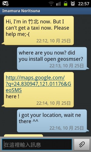
We introduce Open GeoSMS with a quick and real example. Noritsuna-san is a friend of mine from Japan and a guest researcher in our company. One night, I got an SMS from him saying that he can't get taxi home since it's too late. I had no idea where he was and he could not read the street names in Chinese. I thus asked him to send me an Open GeoSMS with our free application. I then got an Open GeoSMS with the coordinate embedded in URL that points to Google Map service. At the end I totally new where he was and drove my little car to rescue him.
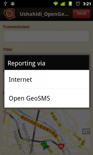
In the previous case, Open GeoSMS sent as a peer to peer message between mobile phones. It can be also used between mobile and server in disaster management. Users who have smart phone with GPS for incident report can attach coordinate in SMS with Open GeoSMS format (usually, with an App such as Ushahidi app on Android that we hacked).
This feature enables users to do incident reporting without a data connection. We know some volunteers bring their own smart phones and work with expensive data roaming fee. This feature also enables the backend server to auto-process the geo-tagged report, and insert this POI to map automatically. Rescuing activity or the resource transportation tasks can be assigned with Open GeoSMS for more specific location information. Especially with the offline map supported such as Open Street Map, POI-based information exchange can be easily achieved through Open GeoSMS.
As for the notification, the server doesn't need to care if the receiver is a smart phone user or not. Open GeoSMS notification is just an SMS and that works for almost every phone. On a smart phone, Open GeoSMS can bring out more information via URL. The latest spec and code are available on Google Code. If the SMS with coordinate is compliant to Open GeoSMS, other applications or services can easily parse it and get the x and y coordinates. Last month during a cyclone simulation of Samoa, PinPointAlerts provided Open GeoSMS as a notification option on http://www.SamoAlert.com so the simulation notification could be sent with this open standard. Our team also shipped five smart phones to Samoa with an Open GeoSMS enabled Ushahidi app installed or this Cyclone Simulation activity. As a result, not only could the general SMS-based incident reports be made, but also the Open GeoSMS style geo-tagged SMS could be sent to server for the possible automation afterwards.
Our team has hacked an Open GeoSMS enabled Ushahidi Android App, now we are working with Ushahidi mobile app team on additional projects to merge our technologies. Our next step is to implement a plug-in for Ushahidi to parse Open GeoSMS in order to gain the automated processing ability. Further objectives include working with offline maps such as Open Street Map (OSM) so users can have a better understanding re incoming Open GeoSMS. For more information and our latest activities, please visit our facebook page.
We really hope this tiny handy open standard can help people in various way :-)

